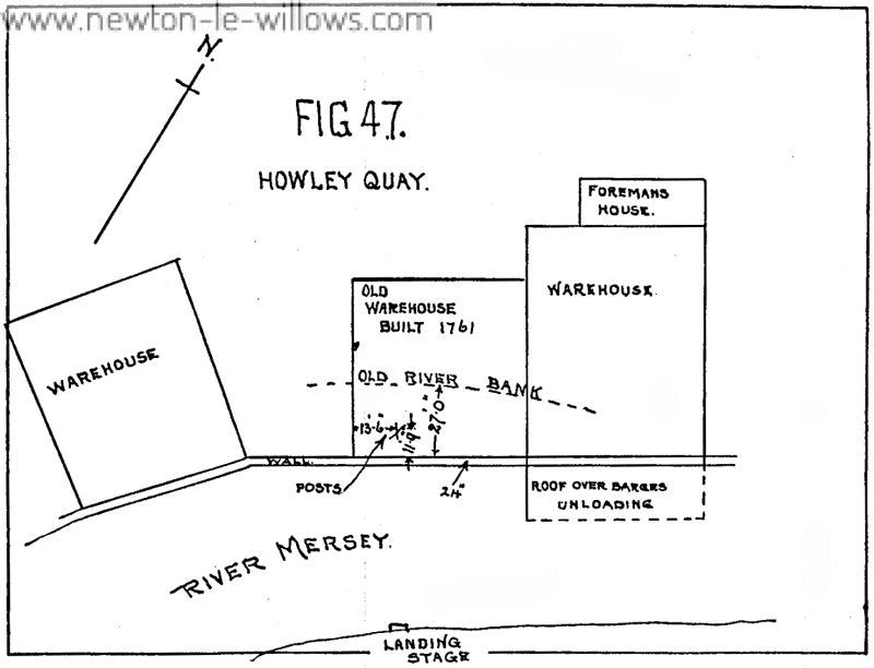
THE ROMAN ROAD FROM NEWTON BROOK TO THE SOUTH OF THE PARISH CHURCH, WARRINGTON. An account of the investigation carried through by G. A. Dunlop, F.S.A., and Colonel B. Fairclough, C.M.G., D .S .0. [Reference Maps, Ordnance Survey, 6 inches to 1 mile ; Lancashire, sheet CVIII, NE., 1928 ; Lancashire, sheet CVIII, SE., 1929 ; Lancashire, sheet CIX, SW., and Cheshire, Part sheet XVI, 1908 ; Lancashire, sheet CXVI, NW. Cheshire, Part sheets XVI and XVII, 1929.] INTRODUCTION. THE Ordnance Survey Maps, Lancashire, sheet CVIII, NE., and Lancashire, sheet…
Read More >>Vulcan to Warrington: The Roman Road