Castle Hill (Road)

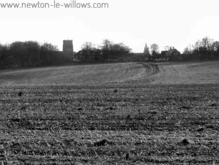
This road is clearly visable going straight across the fields towards the mound, at some points the trackway (road) is over 2 meters higher than the surrounding fields. This next image will take a while to download as its 150kb, sorry its a little larger than normal, but its a full 360 degree view of the area. You can see clearly in this view that the Castle Hill Rd, snakes across the fields from Newton high st directly to the mound, The M6 moterway being the first thing to break…

Read More >>

ST. John the Baptist, Earlestown Parish Church

Canon Whitley, Rector of Newton-in-Makerfield, recognised that the population of Earlestown was growing and there was a need for their own Parish Church. On May 27,1874, Canon Whitley, called a meeting at which it was decided to build a new church in the Earlestown area. The Original Design by Whitley & Fry of Dover The original plans for the Church were drawn up by Messrs. Whitley & Fry of Dover and they produced a design for a building in Early English style to seat 900 persons and costing an esitmated…

Read More >>

Vulcan to Warrington: The Roman Road

THE ROMAN ROAD FROM NEWTON BROOK TO THE SOUTH OF THE PARISH CHURCH, WARRINGTON. An account of the investigation carried through by G. A. Dunlop, F.S.A., and Colonel B. Fairclough, C.M.G., D .S .0. [Reference Maps, Ordnance Survey, 6 inches to 1 mile ; Lancashire, sheet CVIII, NE., 1928 ; Lancashire, sheet CVIII, SE., 1929 ; Lancashire, sheet CIX, SW., and Cheshire, Part sheet XVI, 1908 ; Lancashire, sheet CXVI, NW. Cheshire, Part sheets XVI and XVII, 1929.] INTRODUCTION. THE Ordnance Survey Maps, Lancashire, sheet CVIII, NE., and Lancashire, sheet…

Read More >>